Satellite Images Reveal Nepal and China Flood Devastation
📡 Sydney Morning Herald / The Age · 1 min read ·
Part of composite article Nepal Floods: Mountain Collapse, Not Just a Glacier, Killed Hundreds—Here’s What Really Happened View full article →
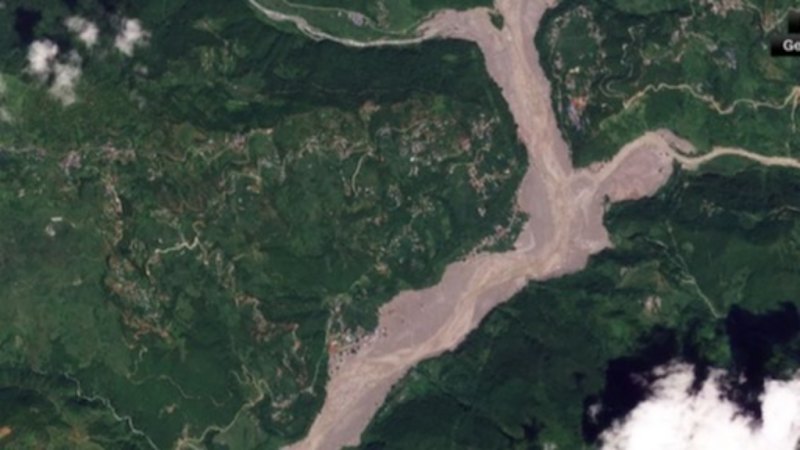
New satellite imagery has revealed the full scale of destruction caused by the flash floods that struck parts of Nepal and China this week. The before-and-after comparisons show entire villages and vast stretches of farmland submerged under muddy water, with roads and bridges washed away.
The floods, triggered by intense rainfall, have left a trail of damage across the affected regions. The images highlight the sudden and violent nature of the water surge, which transformed dry landscapes into raging rivers within hours.
Rescue and relief operations are underway as authorities assess the full extent of the damage. The satellite data provides critical information for emergency teams, helping them identify the hardest-hit areas and prioritize their response efforts.