NASA satellite data tracks Spain's worst-ever fire: 70,000 hectares burned
Part of composite article Spain’s Wildfires Have Burned 70,000 Hectares — the Worst in the Country’s History View full article →
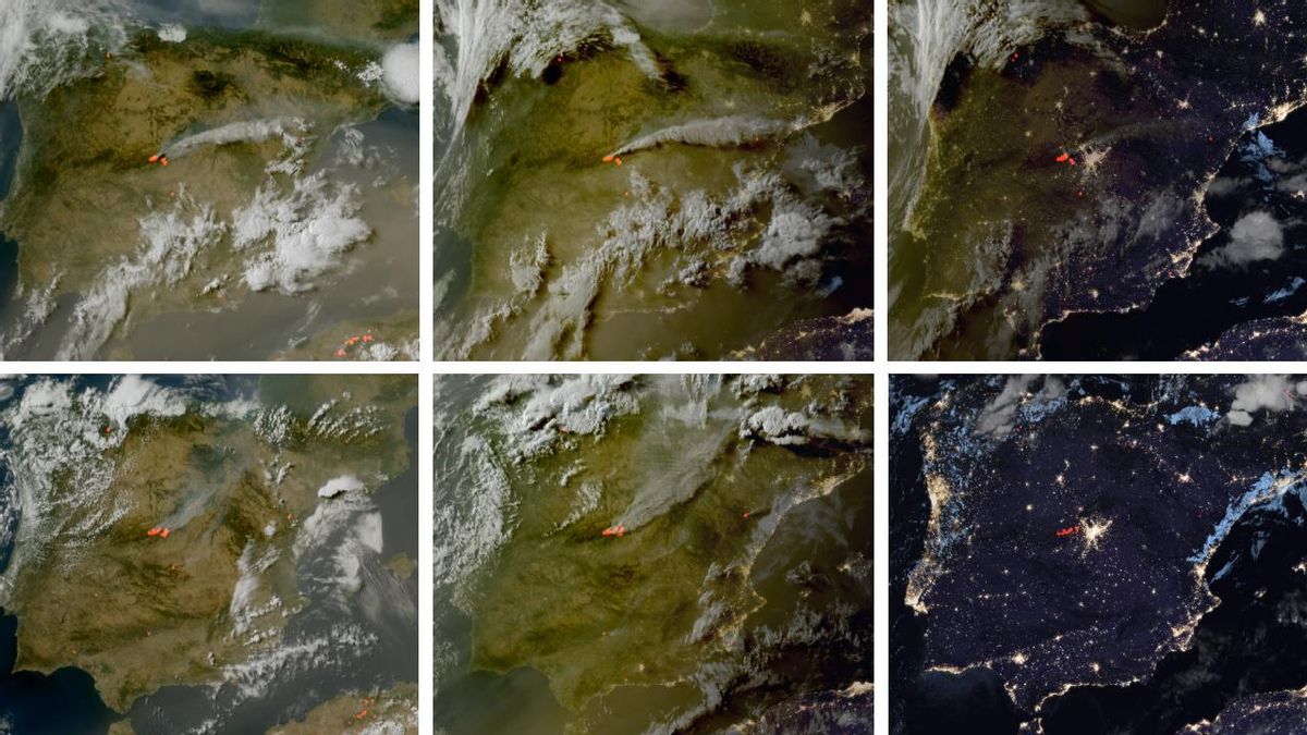
A wildfire in central Spain, which began on July 22, has become the largest in the country's history, burning an estimated 70,000 hectares (173,000 acres) across the provinces of Madrid and Ávila. Authorities say a person has been detained in connection with the fire's origin.
Satellite data from NASA and the European Copernicus program allowed experts to reconstruct the disaster hour by hour. The first thermal anomalies were detected near Burgohondo, Ávila, on the afternoon of July 22. Investigators believe the fire started due to the unauthorized use of heavy machinery.
The fire quickly spread. New hotspots appeared near Villa del Prado, Madrid, on the same evening. These two separate fires later merged.
On July 23, a car burning on the roadside at the entrance to San Martín de Valdeiglesias sparked the largest single blaze. By the next day, the Madrid fires were considered a single front.
The fire threatened the Madrid Deep Space Communications Complex, a NASA facility. Satellite images showed heat points near the complex that afternoon.
A critical factor was the wind. For the first few days, wind blew north, pushing smoke as far as the Pyrenees mountains. On the morning of Saturday, July 25, the wind shifted south, driving the fire toward the Tiétar Valley. This was the worst-case scenario for emergency services, as it brought the two main fire fronts—from Ávila and Madrid—together.
"We do everything to keep them from merging," officials said at the time.
By July 25, the European Forest Fire Information System (EFFIS) estimated more than 40,000 hectares had burned. The government hoped a drop in temperatures would create a "window of opportunity" to slow the fire, but the wind change prevented any positive news.
By July 26, the fires had practically joined north of the San Juan reservoir. Satellite images confirmed the smoke plume now headed south.
The final perimeter estimate from EFFIS on July 27 calculated roughly 70,000 hectares burned across four fires. The fire that started in Ávila alone may become the largest single wildfire ever recorded in Spain. As of the night of July 27, more than 100 hours after ignition, several hotspots remained active.